Table of Contents
Montana national historic sites and battlefields are much more than just places to visit—they are windows into the state’s rich and complex history. The National Monuments in Montana range from the tragic events at Big Hole and Little Bighorn to the frontier commerce of Fort Union and the cowboy legacy of Grant-Kohrs Ranch, these sites offer deep insights into the people and events that shaped Montana and the American West.
Map of Montana Historical Sites
In addition to National Parks in Montana, there are several other notable sites to visit. Here’s a list of those, including both national parks and other protected areas:
National Monuments in Montana
- Big Hole National Battlefield: A historic site commemorating the 1877 battle between the Nez Perce people and the U.S. Army.
- Bighorn Canyon National Recreation Area: This area offers stunning landscapes and outdoor activities along the Bighorn River, straddling the border between Montana and Wyoming.
- Fort Union Trading Post National Historic Site: Located on the Montana-North Dakota border, this site preserves the history of the fur trade in the early 19th century.
- Grant-Kohrs Ranch National Historic Site: A preserved working cattle ranch that represents the frontier cattle era of the late 19th century.
- Little Bighorn Battlefield National Monument: A historic site memorializing the famous 1876 battle where Lt. Col. George Custer and the U.S. Army faced the combined forces of the Lakota and Cheyenne tribes.
Montana National Monuments
Little Bighorn Battlefield National Monument
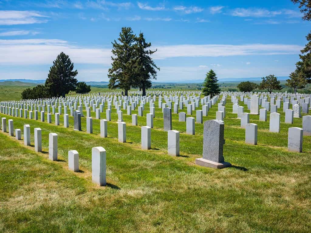
Little Bighorn Battlefield National Monument, located in southeastern Montana, commemorates the infamous Battle of the Little Bighorn, also known as “Custer’s Last Stand.” This battle took place on June 25-26, 1876, and was a key event in the Great Sioux War. The monument honors the U.S. Army’s 7th Cavalry, led by Lt. Col. George Armstrong Custer, as well as the combined forces of the Lakota, Northern Cheyenne, and Arapaho tribes who fought to protect their lands.
Little Bighorn Battlefield History
The Battle of the Little Bighorn was one of the most significant clashes between the U.S. military and Native American tribes during the westward expansion. Custer, tasked with forcing the Sioux and Cheyenne onto reservations, underestimated the size of the Native force he was facing. His 7th Cavalry was overwhelmed, and Custer, along with over 200 of his men, was killed. While the battle was a victory for the Native Americans, it marked a turning point in the U.S. government’s efforts to subdue the Plains tribes.
Exploring Little Bighorn Battlefield National Monument
Visitors to Little Bighorn Battlefield can tour the site where the battle unfolded. Key locations include Last Stand Hill, where Custer made his final stand, and the Indian Memorial, which honors the Native warriors who fought to protect their lands and way of life. The visitor center offers exhibits that detail the events leading up to the battle, as well as the perspectives of both the U.S. soldiers and the Native Americans.
Little Bighorn Battlefield Trails
A 4.5-mile auto tour road winds through the battlefield, with stops at key locations where significant events of the battle took place. Walking trails allow visitors to explore the landscape up close and visit important landmarks like Custer’s Last Stand and the Deep Ravine, where many soldiers fell during the battle.
Little Bighorn Battlefield Weather
The weather at Little Bighorn Battlefield is typically hot and dry in the summer, with temperatures often reaching the 90s. Winters are cold, with snow and temperatures frequently below freezing. Spring and fall offer milder conditions, making them ideal times to visit. Be sure to check the forecast before your visit to ensure a comfortable experience.
Little Bighorn Battlefield Visitor Experience
Little Bighorn Battlefield National Monument provides a somber and educational experience for visitors. The site offers a chance to reflect on the courage and sacrifice of the Native Americans and soldiers who fought here, as well as the broader context of U.S. expansion and its impact on Indigenous peoples. Whether you’re a history buff or simply looking to better understand this pivotal moment in American history, Little Bighorn Battlefield is an essential stop.
Grant-Kohrs Ranch National Historic Site
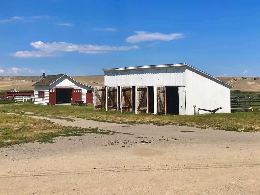
Grant Kohrs Ranch National Historic Site, located in Deer Lodge, Montana, offers visitors a rare glimpse into the history of cattle ranching in the American West. This working ranch preserves the legacy of Montana’s open-range cattle industry, which played a crucial role in the settlement and development of the region. The ranch was originally founded by Canadian fur trader Johnny Grant in the 1850s and was later expanded by Conrad Kohrs, a prominent cattle baron.
Grant-Kohrs Ranch History
The Grant-Kohrs Ranch represents a significant chapter in Montana’s history. Johnny Grant originally established the ranch to raise cattle and trade with local settlers and miners. In the 1860s, Conrad Kohrs, who would later be known as the “Cattle King of Montana,” purchased the ranch and transformed it into one of the largest cattle operations in the West. The ranch’s success was built on the open-range system, which allowed cattle to roam freely across vast areas of public and private land.
Exploring Grant-Kohrs Ranch National Historic Site
Visitors to the ranch can explore the original ranch house, barns, bunkhouses, and other historic structures. The site also offers guided tours that highlight the history of cattle ranching in Montana and the daily lives of the cowboys and ranchers who worked the land. During the summer, visitors can witness demonstrations of traditional ranching activities such as blacksmithing, cattle branding, and horse harnessing.
Grant-Kohrs Ranch Trails
For those looking to stretch their legs, there are walking trails around the ranch that offer scenic views of the surrounding landscape. These trails take visitors through open fields and past historic ranch buildings, providing a peaceful and immersive experience of Montana’s ranching heritage.
Grant-Kohrs Ranch Weather
The weather at Grant-Kohrs Ranch can vary depending on the season. Summers are warm and dry, with temperatures typically in the 70s and 80s, while winters are cold, with snow and temperatures often dipping below freezing. Visitors are advised to dress appropriately for the season, especially during the winter months when ranch activities are more limited.
Grant-Kohrs Ranch Visitor Experience
A visit to Grant-Kohrs Ranch is like stepping back in time to the days when cattle barons ruled the West. The ranch provides an authentic look at Montana’s ranching past and is a must-visit for anyone interested in the history of the American frontier.
Fort Union Trading Post National Historic Site
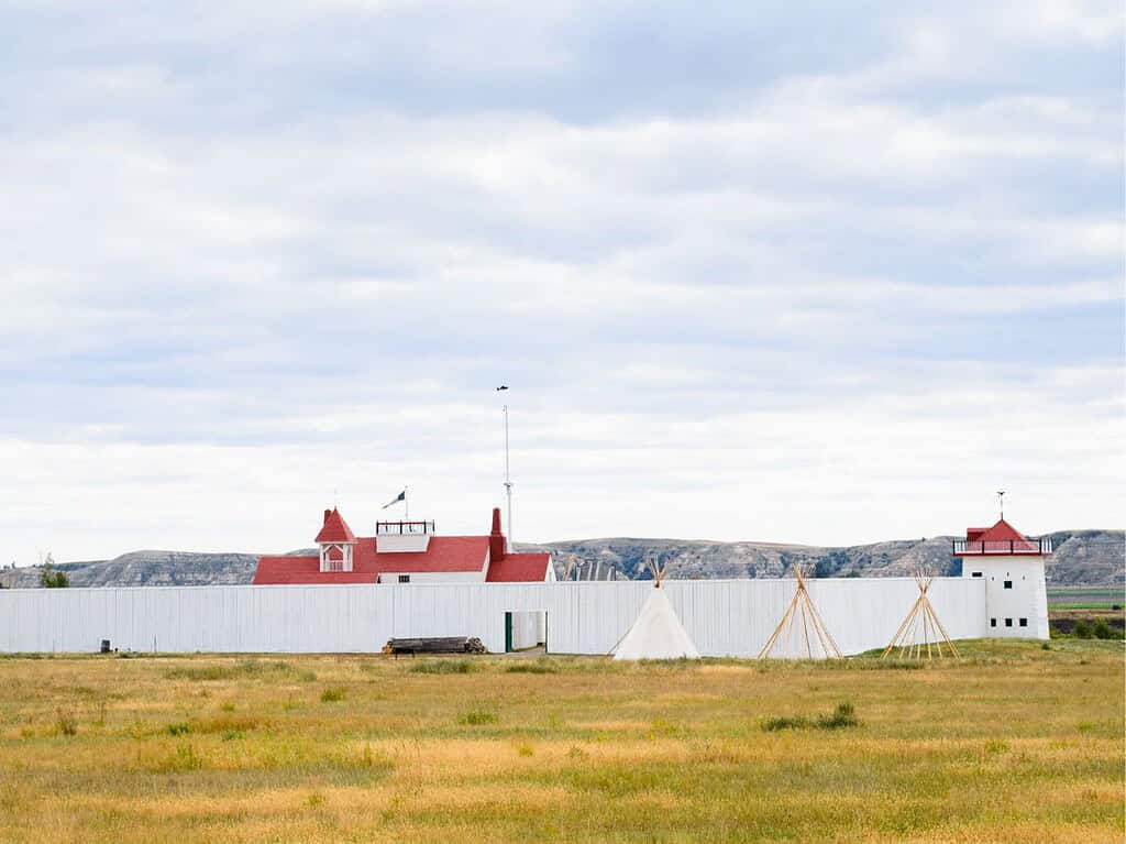
Fort Union Trading Post National Historic Site, located on the Montana-North Dakota border, was once the most important fur trading post on the Upper Missouri River. The fort operated from 1828 to 1867 and served as a major hub of commerce between the Northern Plains tribes, including the Assiniboine, Crow, Blackfeet, and the American Fur Company. Today, the reconstructed site offers a glimpse into Montana’s frontier past.
Fort Union Trading Post History
Fort Union was more than just a trading post—it was a cultural and economic crossroads. Native American tribes would come to the fort to trade buffalo robes and other goods for European-made products such as guns, metal tools, and cloth. The fort helped foster relationships between the tribes and Euro-American traders, although it also became a site where the influences of European colonization became more visible, leading to significant changes in Native American life.
Exploring Fort Union Trading Post National Historic Site
Visitors to the fort can tour a reconstructed section of the original trading post, including the fort’s bastions, trading room, and quarters. Costumed interpreters bring the history of the site to life, demonstrating how trade operated and what life was like for the traders and Native Americans who frequented the post. The site also hosts annual events such as the Fort Union Rendezvous, which celebrates the trading post’s history with reenactments, crafts, and demonstrations.
Fort Union Trading Post Trails
For those looking to explore the surrounding landscape, there are several short trails around the fort that offer views of the Missouri River and the vast prairie that once served as the backdrop to this bustling trade hub. These trails are a great way to reflect on the area’s natural beauty and historical significance.
Fort Union Trading Post Weather
The weather at Fort Union Trading Post varies by season. Summers are warm, with temperatures in the 70s and 80s, while winters can be extremely cold, often dipping below freezing. The site is open year-round, but visitors should dress appropriately for the weather, especially during the winter months.
Fort Union Trading Post Visitor Experience
Fort Union Trading Post is not just a place to learn about fur trading—it’s a portal into Montana’s frontier history. Whether you’re walking through the reconstructed trading post or participating in one of the site’s special events, this historic site offers a unique opportunity to experience the early days of Montana’s settlement.
Pompeys Pillar National Monument
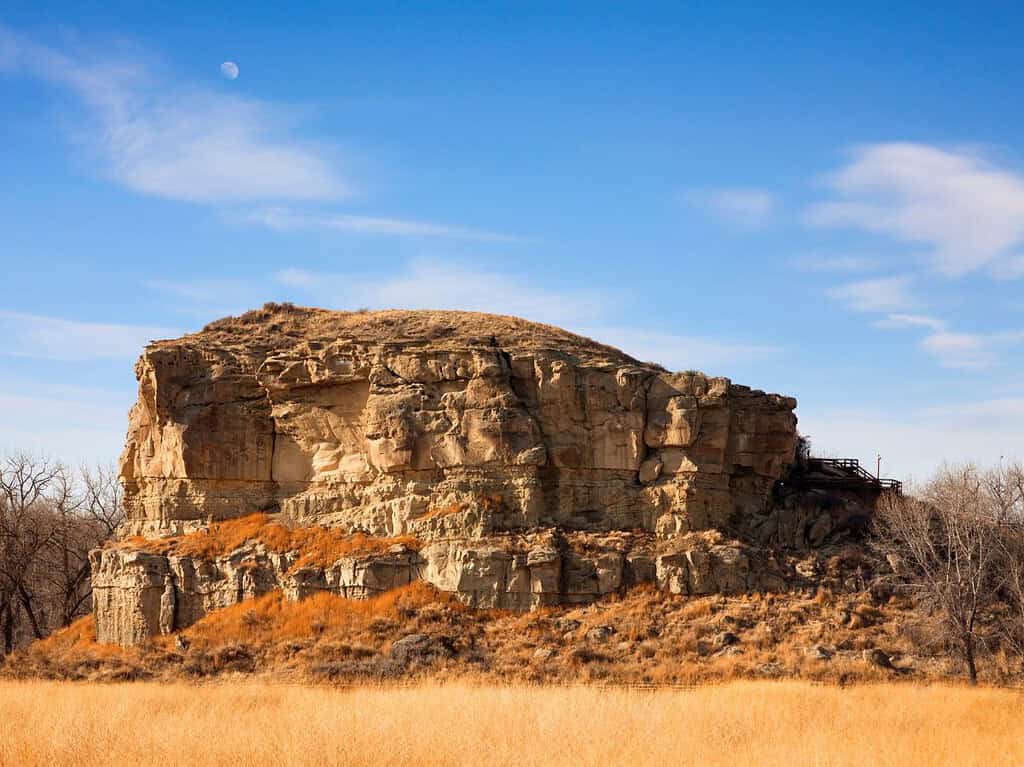
Pompeys Pillar National Monument, located near Billings, Montana, is a sandstone rock formation that holds a special place in American history. Towering 150 feet above the Yellowstone River, this unique site is notable for preserving the only remaining physical evidence of the famed Lewis and Clark Expedition—a signature carved by Captain William Clark into the rock during their westward journey in 1806. Today, Pompeys Pillar serves as a historical landmark and a place of natural beauty, attracting history enthusiasts and nature lovers alike.
Pompeys Pillar National Monument History
Named after Sacagawea’s young son, Jean Baptiste Charbonneau (whom William Clark affectionately called “Pomp”), Pompeys Pillar was a significant waypoint during the return trip of the Lewis and Clark Expedition. On July 25, 1806, Clark carved his name and the date into the soft sandstone, leaving behind an enduring mark of the Corps of Discovery’s exploration of the American West. This inscription is the only known on-site physical evidence of their monumental journey.
The area surrounding the pillar was historically significant to Indigenous tribes, including the Crow, who used the pillar as a vantage point and a place of spiritual importance. Long before Clark’s arrival, Native Americans had left their own petroglyphs and markings on the rock, making it a site of layered historical significance.
Exploring Pompeys Pillar National Monument
Visitors to Pompeys Pillar can see William Clark’s signature up close, preserved behind protective glass to prevent weathering and vandalism. In addition to this historic signature, the monument offers a visitor center with exhibits that detail the history of the Lewis and Clark Expedition, the significance of the Yellowstone River, and the Native American history of the region.
A short hike to the top of the pillar provides stunning panoramic views of the surrounding Yellowstone River Valley. Along the way, interpretive signs explain the natural and cultural history of the area, giving visitors a deeper understanding of its significance.
Pompeys Pillar National Monument Trails
For those looking to explore the area more thoroughly, there are several interpretive trails around the base of Pompeys Pillar that take visitors along the Yellowstone River and through the surrounding grasslands. These trails offer opportunities for birdwatching and viewing local wildlife, such as deer and bald eagles, in a peaceful natural setting.
Pompeys Pillar Weather
The weather at Pompeys Pillar varies by season. Summers are warm and dry, with temperatures often reaching the 80s and 90s, making it an ideal time for hiking and outdoor activities. Winters can be cold, with snow and temperatures dropping below freezing, but the monument remains accessible year-round. Fall and spring offer milder temperatures and are often considered the best times to visit.
Pompeys Pillar Visitor Experience
Visiting Pompeys Pillar National Monument offers a unique opportunity to connect with a key moment in American history. Standing before William Clark’s signature and taking in the expansive views of the Yellowstone River, visitors can reflect on the challenges and triumphs of the Lewis and Clark Expedition. The monument’s interpretive trails, visitor center, and historical exhibits make this a rich educational experience for people of all ages.
Upper Missouri River Breaks National Monument History
The Upper Missouri River Breaks National Monument, located in central Montana, is a rugged and remote landscape that preserves one of the last wild sections of the Missouri River. Designated as a national monument in 2001, this area encompasses over 375,000 acres of public land and features striking sandstone cliffs, expansive prairie, and winding river corridors. The monument is not only rich in natural beauty but also steeped in history, with connections to the Lewis and Clark Expedition, Indigenous cultures, and the early days of American westward expansion.
Upper Missouri River Breaks National Monument History
The Upper Missouri River has long been an essential waterway for Native American tribes, explorers, trappers, and settlers. For millennia, Indigenous peoples, including the Blackfeet and Gros Ventre, lived along the river, using it for sustenance, transportation, and trade. In 1805, the Lewis and Clark Expedition traveled through this region, noting its rugged beauty and abundant wildlife in their journals.
During the 19th century, steamboats carried goods and passengers up the Missouri River, contributing to the development of Montana’s frontier economy. The river’s significance as a transportation route continued into the early 20th century, but today it is primarily valued for its scenic beauty and recreational opportunities.
Exploring Upper Missouri River Breaks National Monument
The Upper Missouri River Breaks offers a true wilderness experience, with opportunities for camping, hiking, boating, and wildlife viewing. The Missouri River itself is the centerpiece of the monument, with its meandering waters cutting through steep cliffs and rolling prairies. Visitors can canoe or kayak along the river, following in the footsteps of Lewis and Clark while enjoying the solitude and natural beauty of the Breaks.
For those interested in hiking, the monument has several trails that offer breathtaking views of the river and surrounding landscape. These trails range from easy walks to more challenging hikes that take visitors deep into the rugged backcountry. Along the way, hikers may encounter a variety of wildlife, including bighorn sheep, elk, mule deer, and golden eagles.
Upper Missouri River Breaks Wildlife
The monument is home to an impressive array of wildlife. The river supports healthy populations of fish, including paddlefish, catfish, and walleye, making it a popular destination for anglers. The surrounding landscape is habitat for large mammals such as bison, bighorn sheep, and pronghorn, as well as predators like mountain lions and coyotes. Birdwatchers will also find plenty to enjoy, with the area providing habitat for a wide range of bird species, including raptors, waterfowl, and songbirds.
Upper Missouri River Breaks National Monument Weather
The weather in the Upper Missouri River Breaks is typical of Montana’s high plains region, with hot, dry summers and cold, snowy winters. Summer temperatures can reach into the 90s, while winter temperatures often drop below freezing. Spring and fall offer milder weather, making them the most popular times for boating and hiking. However, the area’s remote location means that visitors should be prepared for sudden changes in weather and pack accordingly.
Upper Missouri River Breaks Visitor Experience
Visiting the Upper Missouri River Breaks National Monument is a chance to experience one of the last truly wild sections of the Missouri River. Whether you’re paddling down the river, hiking along the cliffs, or simply enjoying the solitude of the prairie, the monument offers an unparalleled opportunity to connect with nature and history. Its remote location and rugged terrain make it an ideal destination for those seeking adventure and a deeper connection to Montana’s wilderness.
Garnet Ghost Town
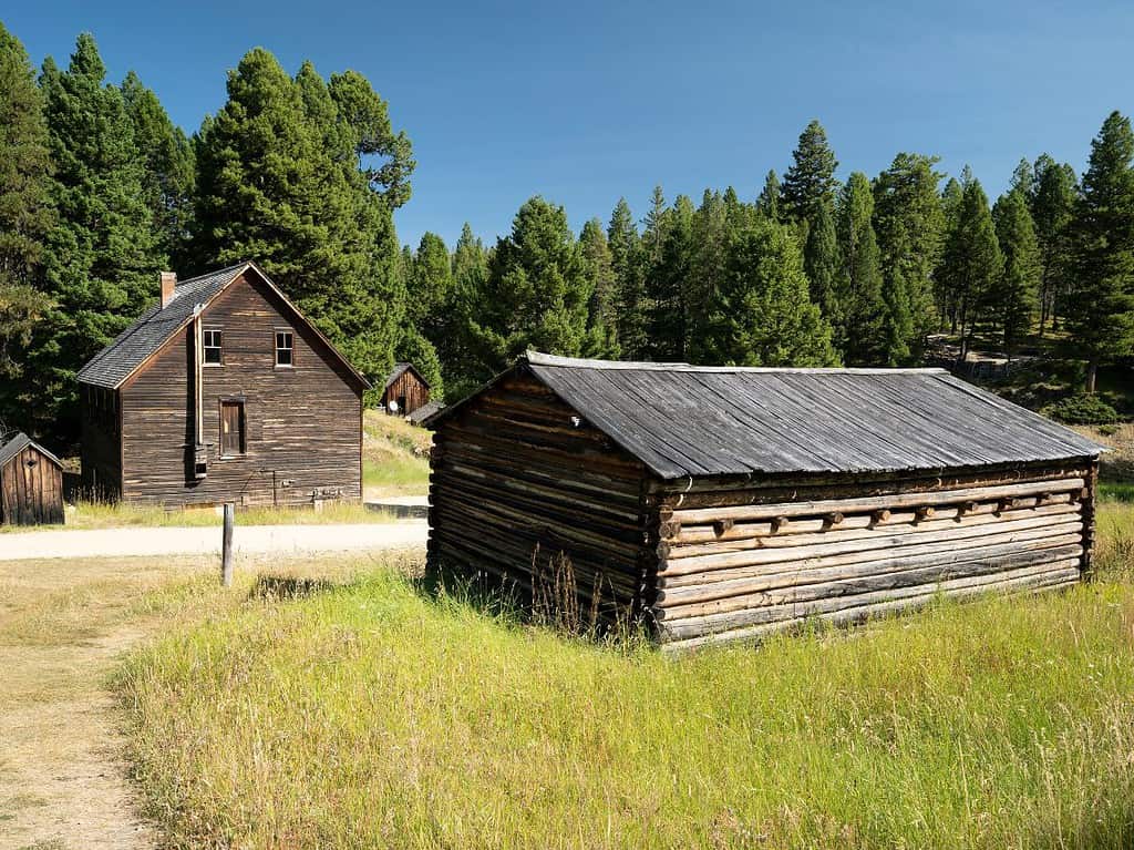
Garnet Ghost Town, nestled in the mountains of western Montana, offers visitors a fascinating glimpse into the past.
Once a thriving gold mining town in the late 1800s, Garnet was abandoned when the mines ran dry, leaving behind well-preserved buildings and artifacts.
Today, Garnet Ghost Town is one of the best-preserved ghost towns in Montana, giving visitors the chance to explore old cabins, a saloon, and the general store, all while learning about the area’s mining history.
The town’s remote location adds to its charm, making it a unique destination for history buffs and adventure seekers alike.
Big Hole National Battlefield
Big Hole National Battlefield, located in the Bitterroot Valley of southwestern Montana, preserves the site of a tragic and bloody encounter between the U.S. Army and the Nez Perce Tribe during the Nez Perce War of 1877. This historic site is an important reminder of the complex and often violent conflicts between Indigenous peoples and the U.S. government during the westward expansion of the 19th century.
Big Hole National Battlefield History
The Big Hole Battle occurred on August 9-10, 1877, when the U.S. Army launched a surprise attack on the Nez Perce people, who were fleeing persecution in an attempt to reach safety in Canada. The Nez Perce had been pursued by U.S. forces after refusing to move to a reservation. At the time of the attack, many Nez Perce were encamped along the Big Hole River. The battle resulted in significant casualties on both sides, with numerous women, children, and warriors of the Nez Perce losing their lives.
Exploring Big Hole National Battlefield
Today, visitors can explore the battlefield and gain insights into this pivotal moment in American history. The site features a visitor center with exhibits detailing the Nez Perce War, the events leading up to the battle, and the perspectives of both the Nez Perce people and the U.S. Army. Ranger-led talks and self-guided tours provide additional context, making this a deeply moving place of reflection and learning.
Big Hole National Battlefield Trails
Several interpretive trails wind through the battlefield, taking visitors past key locations such as the Nez Perce camp and the positions held by the U.S. soldiers. The trails allow visitors to walk the land where the battle occurred, offering a poignant experience as they reflect on the tragedy and bravery of the Nez Perce people.
Big Hole National Battlefield Weather
The weather at Big Hole National Battlefield varies significantly by season. Summers are typically mild, with temperatures ranging from the 50s to 80s, while winters can be harsh, with snow and freezing temperatures. If you’re planning a visit, be sure to check the forecast to ensure comfortable and safe exploration of the site.
Big Hole National Battlefield Visitor Experience
A visit to Big Hole National Battlefield provides a chance to better understand the Nez Perce people’s struggle for freedom and survival. The solemn landscape, combined with the informative visitor center and ranger programs, offers a unique opportunity to connect with this important chapter of American history.
These sites, while not designated as national parks, are part of the U.S. National Park Service and play important roles in preserving both the natural beauty and historical significance of Montana.
