Table of Contents
Where is Algeria located? Algeria is a country located in North Africa, forming part of the Maghreb region. It is the largest country in Africa and the Arab world, and the tenth-largest in the world.
Algeria is situated in the northwestern part of the African continent, bordering the Mediterranean Sea to the north. It shares borders with several neighboring countries. To the northeast, it is bordered by Tunisia. To the east, it shares a border with Libya. To the southeast, it is bounded by Niger. To the south, it shares a border with Mali and Mauritania. To the west, it is bordered by the Western Sahara (disputed territory) and Morocco.
Where is Algeria located: Africa.
Location of Algeria on the World Map
Algeria World
Map of Algeria.
Algeria Profile – Where is Algeria located
Here are 10 of the most important facts about Algeria:
- Official Name: People’s Democratic Republic of Algeria
- Capital City: Algiers
- Population: Approximately 44 million (as of 2021)
- Official Language: Arabic and Berber
- Currency: Algerian Dinar (DZD)
- Major Religion: Islam (predominantly Sunni)
- Government: Unitary semi-presidential republic
- Area: Approximately 2,381,741 square kilometers
- GDP (Gross Domestic Product): $145.2 billion (as of 2021)
- Main Exports: Petroleum and natural gas, minerals, and agricultural products.

Borders of Algeria
Algeria shares land borders
| Bordering Country | Approximate Length of Border (in kilometers) |
|---|---|
| Tunisia | 1,034 km |
| Libya | 982 km |
| Niger | 951 km |
| Mali | 1,376 km |
| Mauritania | 463 km |
| Morocco | 1,559 km |
Algeria Map
Navigate over this map with your mouse to discover the Algeria map location.
Algeria
Most Extreme Points of Algeria
Algeria has several extreme points in different directions:
- Northernmost Point: Located near the Mediterranean coast, east of the city of Annaba.
- Southernmost Point: Deep in the Sahara Desert, near the border with Niger and Mali.
- Easternmost Point: Situated at the border with Tunisia, close to the town of Souk Ahras.
- Westernmost Point: On the border with Morocco, west of the city of Tindouf.
Highest Points of Algeria
The highest point in Algeria is Mount Tahat, reaching an elevation of approximately 3,003 meters above sea level. It is part of the Hoggar Mountain range.
| No. | Mountain | Elevation (meters) |
|---|---|---|
| 1 | Mount Tahat | 3,003 |
| 2 | Assekrem | 2,908 |
| 3 | Mount Afao | 2,650 |
| 4 | Adrar n’Fad | 2,595 |
| 5 | Djebel Aïssa | 2,580 |
How big is Algeria?
Algeria covers an area of approximately 2,381,741 square kilometers, making it the largest country in Africa and the 10th largest in the world.
Comparison with Neighboring Countries
Here is a comparison of Algeria with its neighboring countries based on approximate size and population as of 2021:
| Country | Approximate Size (sq. km) | Approximate Population | Jordan’s Size Compared to Neighboring Country | Algeria’s Population Compared to Neighboring Country |
|---|---|---|---|---|
| Tunisia | 163,610 | 11.8 million | 14.56 times bigger | 3.73 times bigger |
| Libya | 1,759,540 | 6.9 million | 1.35 times bigger | 6.38 times bigger |
| Niger | 1,267,000 | 24.2 million | 1.88 times bigger | 1.82 times bigger |
| Mali | 1,240,192 | 20.3 million | 1.92 times bigger | 2.17 times bigger |
| Mauritania | 1,030,700 | 4.6 million | 2.31 times bigger | 9.57 times bigger |
| Morocco | 710,850 | 36.9 million | 3.35 times bigger | 1.19 times bigger |
What to Visit in Algeria?
Algeria offers a rich tapestry of history, culture, and natural beauty. Here are the top 10 tourist attractions:
- Algiers: The capital city, known for its Ottoman architecture, bustling Kasbah, and the Notre Dame d’Afrique.
- Oran: Algeria’s second-largest city, famous for its Spanish colonial architecture, the Great Mosque, and the picturesque seafront.
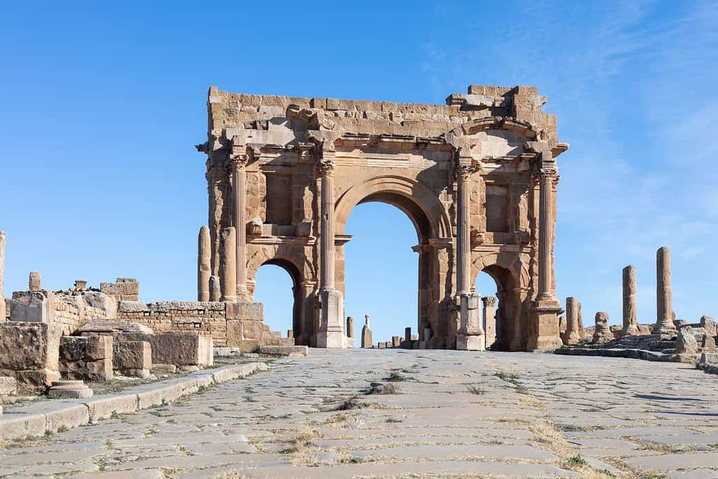
- Timgad: A UNESCO World Heritage Site, this ancient Roman city offers well-preserved ruins, including a triumphal arch and a theater.
- Djémila: Another UNESCO World Heritage Site, Djémila is known for its impressive Roman ruins set in a mountainous landscape.
- Tassili n’Ajjer: A vast plateau in the Sahara, home to thousands of prehistoric rock carvings and paintings.
- Hoggar Mountains: Located in the Sahara’s central part, these mountains offer stunning landscapes and a chance to experience Tuareg culture.
- Annaba: A coastal city known for its beautiful beaches, the Basilica of St. Augustine, and the Ruins of Hippo Regius.
- Constantine: A city famous for its dramatic bridges spanning deep gorges, historic palaces, and the Grand Mosque.
- Ghardaïa: A group of fortified villages in the M’zab Valley, showcasing unique Mozabite architecture and culture.
- Tipaza: A coastal town known for its ancient Roman ruins, including a basilica, amphitheater, and thermal baths.
These Algerian destinations provide a diverse range of experiences, from exploring ancient Roman ruins and UNESCO World Heritage Sites to experiencing the serene beauty of the Sahara Desert and the Mediterranean coast. Visitors should respect local customs and traditions, especially in more traditional areas.
More About Algeria
[the-post-grid id=”53368″ title=”Algeria Main page”]
